Ancient Arabia · AlUla
Hegra (Al-Hijr)
The largest conserved Nabataean site south of Petra, Hegra preserves a desert city, ancient wells and more than a hundred monumental tombs cut into sandstone outcrops along the caravan routes of north-west Arabia.
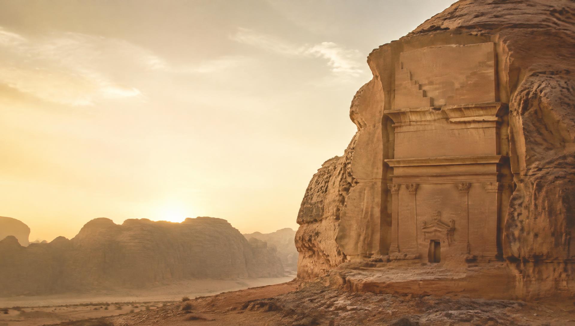
A Nabataean city in north-west Arabia
Hegra, also known as al-Hijr and Mada’in Salih, occupied a broad plain ringed by isolated sandstone masses. The Nabataeans developed it as their principal southern city, roughly 500 kilometres south of their capital at Petra.
The visible rock-cut tombs dominate the landscape, but Hegra was a living settlement as well as a cemetery. Archaeology has identified traces of a residential zone, a fortified area, religious spaces, agricultural activity and a sophisticated system for obtaining and storing water.
At the crossroads of trade
Hegra prospered near routes connecting southern Arabia with the Levant, Egypt and the Mediterranean. Caravans transported aromatics and other valuable goods across great distances, while local routes linked the oasis communities of north-west Arabia.
The Nabataeans drew wealth from this movement and developed a culture that combined Arabian traditions with artistic and architectural ideas circulating across the Hellenistic and Roman worlds. Inscriptions reveal a multilingual environment in which Nabataean Aramaic was prominent and other languages were also present.
Monuments cut from sandstone
UNESCO records 111 monumental tombs at Hegra, 94 of them with decorated façades. Craftspeople carved many from the top downward, removing the cliff face in a carefully planned sequence. Crow-stepped elements, columns, pediments and eagles create imposing fronts while the burial chambers behind them are comparatively restrained.
The tomb inscriptions are unusually informative. Many name the person who commissioned a monument, establish ownership, record a date and warn against unauthorized reuse. They turn the façades into legal and social documents, preserving family relationships and Nabataean conventions alongside architecture.
Qasr al-Farid, the ‘Lonely Castle,’ is Hegra’s best-known monument. Its tall façade stands alone in a sandstone outcrop and was left unfinished, allowing the process of carving to be read directly in the rock.
Water in an arid landscape
Hegra’s success depended on groundwater. Dozens of wells were cut into the plain, some using earlier water sources, enabling permanent settlement and cultivation in an environment of low rainfall.
Channels, cisterns and the careful placement of wells demonstrate practical knowledge of the local geology. This managed landscape is as important to understanding Hegra as its monumental art: commerce and construction depended on a stable oasis economy.
Before and after the Nabataeans
Human activity at Hegra predates the city’s Nabataean florescence. Rock surfaces preserve drawings and inscriptions from different periods, offering evidence of travellers and communities who crossed the landscape long before the monumental tombs were built.
Rome annexed the Nabataean kingdom in 106 CE, incorporating Hegra into the province of Arabia. Occupation continued, but the city gradually lost its earlier importance as patterns of trade changed. Centuries later, the Qur’an’s references to al-Hijr and the people of Thamud gave the place a powerful religious and cultural resonance.
Research, conservation and access
In 2008 Hegra became Saudi Arabia’s first property inscribed on the UNESCO World Heritage List. The inscription recognizes the exceptional preservation of its Late Antiquity architecture, inscriptions, wells and earlier rock art.
Archaeological missions continue to study the settlement and its surrounding landscape. Managed access, monitoring of fragile sandstone and controls on development are central to preserving the site while allowing visitors to understand Hegra as a complete cultural landscape rather than a collection of isolated façades.
Sources
- 1.Hegra Archaeological Site (al-Hijr / Madâin Sâlih) — UNESCO World Heritage CentreUNESCO